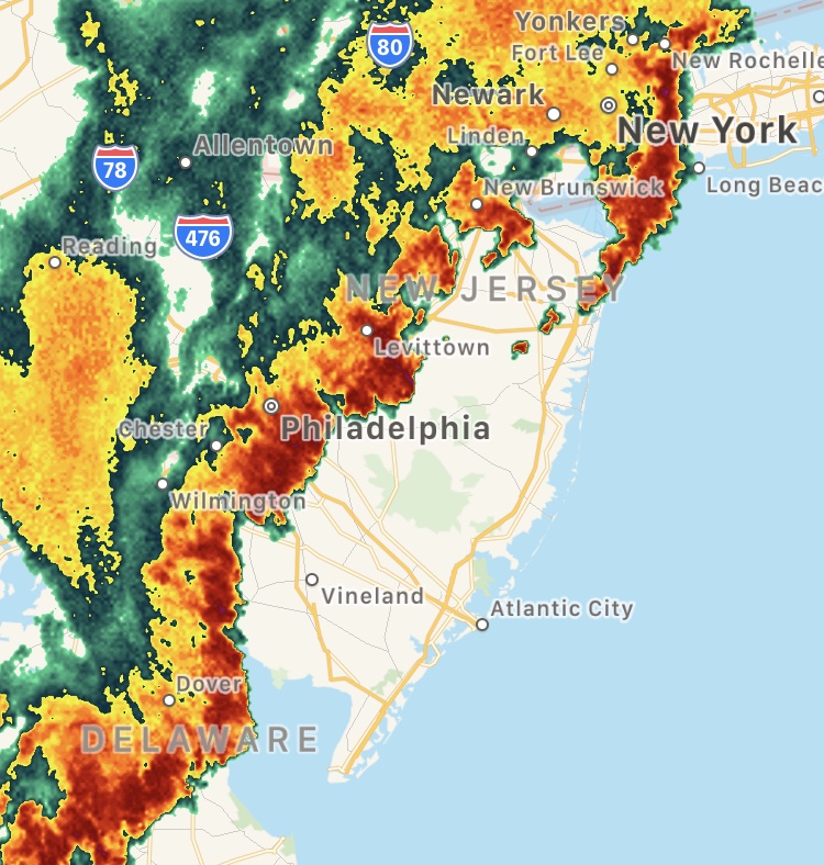
NWS radar, 6:20 p.m., Aug. 7, 2019. (Credit: NWS)
The Jersey Shore was preparing for severe thunderstorms Wednesday evening, with winds whipping through streets on the barrier island, whitecaps visible on Barnegat Bay and mainland neighborhoods bracing for potential flooding. Tides were also running much higher than normal and portions of Route 35 were beginning to flood by 6 p.m.
A severe thunderstorm watch was in effect until 9 p.m. and a warning was in effect until 7:15 p.m. The warning notice calls for a thunderstorm that could carry 60 m.p.h. wind and penny-sized hail. A flash flood watch was also in effect.
“Damage to roofs, siding, trees, and power lines is possible,” the watch notice said.
|
|
Thunderstorms would mainly roll through before 11 p.m. Some storms could be severe, with large hail, damaging winds, gusty winds, and heavy rain, the National Weather Service said.
A chance of thunderstorms will continue until 2 p.m. Thursday, after which skies will be partly sunny.


Police, Fire & Courts
Brick Physician and Family Killed in Upstate N.Y. Plane Crash


Police, Fire & Courts
Brick Physician and Family Killed in Upstate N.Y. Plane Crash


Police, Fire & Courts
Brick Father and Son Arrested for Drug, Weapons Offenses


